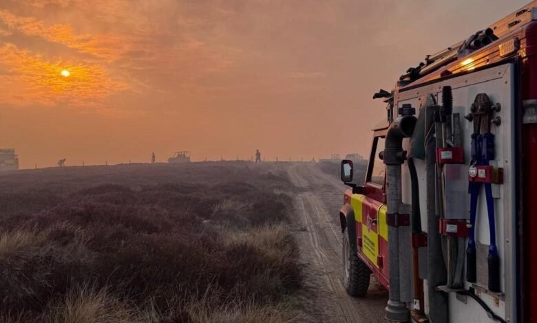
Fylingdales Moor is one of North Yorkshire’s most fascinating upland landscapes, where sweeping heather, ancient archaeology, important wildlife habitats and modern military technology exist side by side. Located within the North York Moors, the landscape has a character that changes with the weather. On a clear day, the open horizon feels spacious and peaceful; under a dramatic sky, the same hills can appear wild, remote and wonderfully atmospheric.

The area has attracted renewed attention since the devastating 2025 wildfire, which became one of the most significant incidents faced by North Yorkshire Fire and Rescue Service. Today, visitors can still explore the wider landscape, but responsible access is particularly important because the moor remains vulnerable to erosion and environmental damage. Understanding its history, wildlife, walking opportunities, military connections and wildfire recovery helps visitors appreciate why this remarkable part of North Yorkshire deserves careful protection.
Where Is Fylingdales Moor?
Fylingdales Moor is situated in North Yorkshire within the wider North York Moors National Park, close to places including Robin Hood’s Bay, Fylingthorpe and Whitby. Its location makes it especially appealing to visitors who want to combine a moorland experience with the dramatic Yorkshire coastline. The landscape rises away from the coast into broad areas of open heath and peatland, creating long views and a strong sense of space.
The moor is also closely associated with RAF Fylingdales, the prominent radar installation that has watched the skies from the area for decades. The station is an important part of the landscape’s modern identity, although it should be distinguished from the surrounding public countryside. Visitors should respect all military boundaries, signs and restrictions while enjoying viewpoints and public rights of way in the surrounding area.
The Landscape and Natural Beauty
The character of Fylingdales Moor comes from a mixture of heather, grassland, peatland and open upland terrain. Much of the landscape has been shaped by natural processes as well as centuries of human management. The result is a distinctive environment that can look deceptively simple from a distance, yet contains complex habitats supporting specialist plants, insects and birds.
Peatland is particularly important because peat stores carbon and can hold significant amounts of water. It also provides valuable habitat for wildlife associated with upland environments. The 2025 wildfire demonstrated the vulnerability of these landscapes during prolonged periods of hot, dry weather. Fire can affect vegetation on the surface while also penetrating deep into peat, creating hidden heat and making recovery much more complicated than simply extinguishing visible flames.
Wildlife on Fylingdales Moor
Wildlife is one of the most rewarding reasons to explore the moor. Open upland habitats provide important areas for birds such as merlin, golden plover, curlew, lapwing and snipe. The wider North York Moors landscape is recognised for its importance to upland birdlife, with large areas receiving environmental designations because of their habitats and species. Patient visitors may see birds hunting low over the heather or hear calls carried across the open landscape.
The area is particularly interesting during spring and early summer, when breeding birds are active and vegetation begins to change colour. Visitors should observe wildlife from a respectful distance and keep dogs under control where required. Staying on designated routes is not simply a matter of personal safety; it also helps reduce disturbance to sensitive habitats and gives damaged areas an opportunity to recover following the wildfire.
The History of Fylingdales Moor
The history of Fylingdales Moor stretches far beyond modern roads and radar installations. Archaeological evidence across the surrounding landscape demonstrates that people have interacted with these uplands for thousands of years. Prehistoric rock art, ancient monuments, tracks and other landscape features provide clues about communities that lived, travelled and worked here long before the modern North York Moors existed in its present form.
Military activity later added another significant layer to the landscape. Parts of the moor were historically used as a military training area, with troops practising battle tactics and artillery exercises taking place among the heather. Remnants of this activity can still be found in the wider landscape, although visitors should never investigate suspicious objects or unexploded material. The combination of archaeology and military history makes the moor an unusually rich cultural landscape.
RAF Fylingdales and Its Modern Role
RAF Fylingdales is perhaps the most recognisable modern feature associated with the moor. The station provides continuous ballistic missile early-warning services for the UK and US Governments and also contributes to monitoring objects in space. Its role places the North Yorkshire landscape within an international defence and space-monitoring network, creating an extraordinary contrast between ancient moorland and highly advanced technology.
The station has changed considerably since its early years. The famous three radar “golf balls” that once dominated the skyline were replaced by the distinctive pyramid-shaped radar structure that visitors can see today. Although the installation forms part of the area’s visual identity, it remains an operational military site. Visitors should therefore admire it from appropriate public areas and never attempt to cross restricted boundaries.
NMD Missile Interceptors at Fylingdales Moor
Searches for NMD missile interceptors at Fylingdales Moor can cause confusion because early-warning radar and missile interception are separate functions. RAF Fylingdales is publicly described by the Royal Air Force as providing ballistic missile early warning and space monitoring. Its radar detects and tracks objects and potential threats, helping provide information to the relevant authorities.
This distinction matters when discussing the military history of the area. A radar station capable of detecting and tracking a missile is not automatically a site where interceptor missiles are physically based. Articles discussing the subject should therefore avoid repeating unverified claims and should rely on official defence information when describing the station’s current capabilities and responsibilities.
The Fylingdales Moor Fire in 2025
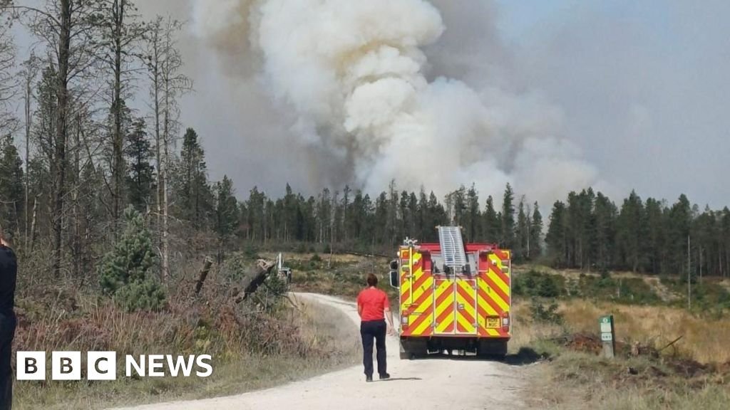
The 2025 wildfire became a major chapter in the recent history of the landscape. The incident began with a fire in a remote forested area in June, and firefighting was complicated by difficult terrain, deep-seated burning and limited access to water. The fire later breached established firebreaks and spread towards the moor near RAF Fylingdales, eventually developing into a major incident during August.
At its peak, the wildfire affected an area of up to 25 square kilometres. Strong winds, dry conditions, continuous vegetation and deep peat contributed to extreme fire behaviour. Firefighters and partner organisations faced an additional hazard because the landscape had historically been used as a military training range and contained unexploded ordnance. Despite the scale and complexity of the incident, there was no loss of life, no serious injuries and no damage to homes, while RAF Fylingdales was successfully protected.
What Caused the Fylingdales Moor Fire?
The cause of the wildfire was investigated extensively after the emergency. Investigators examined witness statements, video and photographic evidence, the physical site and fire patterns. Several possible causes were considered and discounted during the investigation, including lightning, utilities, fireworks and other potential ignition sources. This careful process was important because early speculation about a wildfire can easily become confused with confirmed evidence.
In February 2026, North Yorkshire Fire and Rescue Service announced that its investigation had concluded the fire was believed to have been caused by outdoor cooking using a naked flame, such as a campfire or gas burner. The finding highlights the extraordinary danger of even a small flame during hot, dry and windy conditions. The service subsequently urged countryside visitors to respect restrictions on barbecues and campfires, dispose of smoking materials safely and take particular care in rural environments.
The Fire Response and Unexploded Ordnance
Fighting the wildfire was unusually difficult because firefighters were working in remote terrain with limited water supplies and restricted access. Deep burning within peat meant that visible flames did not always tell the full story. Heat could remain underground and allow fire to continue spreading beneath the surface, creating additional challenges for crews trying to establish secure control lines.
The historic military use of the moor created another serious complication. Firefighters encountered unexploded ordnance, meaning conventional firefighting tactics could not always be used safely. Around 20 “cook-offs” involving buried munitions were recorded during the incident, requiring crews and partner agencies to adapt their approach. The experience demonstrated how environmental hazards and historic land use can combine to make a rural wildfire exceptionally complex.
Fylingdales Moor Fire Today and Current Access
People searching for “fylingdales moor fire today” should understand that wildfire information is highly time-sensitive. The major 2025 incident is now a historical event rather than an ongoing emergency, but its environmental effects continue to influence the landscape. North Yorkshire Fire and Rescue Service ended its active incident response on 22 December 2025, after which recovery and restoration work continued.
Current visitors should check the latest information before travelling because conditions can change during periods of high wildfire risk or restoration work. As of summer 2026, the North York Moors National Park states that public rights of way and open access are open, while also warning that the landscape remains vulnerable to further damage and erosion. Visitors are asked to follow advisory signs and remain on designated paths.
Fylingdales Moor Walks and Walking Safety
Fylingdales Moor walks can provide an excellent way to experience the character of the North York Moors. Open views, heather-covered slopes, historic features and changing weather combine to create an atmosphere that is very different from an ordinary countryside walk. However, moorland routes can become challenging when rain, wind, fog or poor visibility arrives, so visitors should plan carefully rather than relying entirely on mobile-phone navigation.
Good preparation includes sturdy walking footwear, waterproof clothing, sufficient water, food and a reliable means of navigation. The North York Moors National Park provides walking resources and routes covering different lengths and levels of difficulty, making it easier for visitors to choose an appropriate outing. Before leaving, walkers should also check current rights of way, temporary diversions, weather conditions and any wildfire-related advice.
Visiting the Moor After the Wildfire
The landscape is still recovering from the effects of the 2025 fire. Burned vegetation, exposed peat and altered ground conditions can increase the risk of erosion, particularly when visitors leave established routes. Even where an area appears safe and dry, the ecological effects of a major wildfire can continue for years. Recovery therefore depends partly on giving damaged habitats enough time and space to regenerate.
Visitors can make a positive contribution simply by following the guidance provided by the National Park. Stay on designated paths, observe advisory signs, avoid damaged areas where restrictions apply and never light fires or use barbecues where they are prohibited. The National Park has specifically highlighted the continuing vulnerability of the landscape and the importance of responsible behaviour during restoration.
Conservation and Responsible Tourism
Conservation on the moor involves more than protecting attractive scenery. It means safeguarding peatlands, wildlife habitats, archaeological remains and the cultural character of the landscape. Visitors have an important role because thousands of small decisions can collectively influence how quickly vulnerable areas recover. A single shortcut across fragile vegetation may seem insignificant, but repeated footfall can widen tracks and accelerate erosion.
Responsible tourism is particularly important during periods of elevated wildfire risk. The National Park has advised visitors not to use barbecues, stoves or open fires during periods of extreme wildfire danger and encourages people to take cold picnics instead. Smoking near moorland can also create a serious ignition risk. Simple precautions such as taking litter home and disposing of smoking materials safely can help protect the landscape.
Best Time to Explore Fylingdales Moor
Each season gives the moor a different personality. Spring brings fresh growth and increased bird activity, while summer can offer long daylight hours and attractive heather landscapes. Autumn introduces softer colours and dramatic skies, while winter reveals the raw character of the uplands, particularly when frost, wind or mist moves across the open hills.
The best time to visit should therefore depend on more than scenery. Weather, daylight, ground conditions, wildfire risk and current access arrangements all matter. During periods of dry weather, visitors should pay particular attention to fire restrictions. A beautiful sunny afternoon may be ideal for photography, but the same conditions can increase the vulnerability of dry moorland vegetation to ignition and rapid fire spread.
Conclusion
Fylingdales Moor brings together some of the most compelling elements of North Yorkshire in one landscape. Ancient archaeology sits beneath wide skies, wildlife moves through heather and peatland, walkers cross historic routes, and the distinctive RAF Fylingdales radar installation provides a reminder that this peaceful-looking countryside also has an important modern defence role.
The 2025 wildfire has added a powerful lesson to the area’s story. Its scale showed how quickly fire can transform moorland when dry vegetation, strong winds and deep peat combine, while the investigation demonstrated the potentially devastating consequences of a naked flame. For future visitors, the message is clear: explore with care, respect the landscape, follow current guidance and leave the moor in a condition that allows its wildlife, heritage and habitats to recover and thrive.